Updated March 29th: Do not use Google Maps to find the blinds. You can use Google Maps to get to Dry Landing Road & St. Croix Trail Road, 46.113886, -92.091977. Blind 1 blue is a new (west). There are no dancing birds at the north lek. Blind 2 green (east) and Blind 3 red (south) are the same as previous years but directions may be different. Use the directions on this page.
From the Dry Landing & St. Croix Trail intersect, 46.113886, -92.091977, follow directions below for each blind or click on each Blind Access for latitude and longitude directional map. ‘STG Blind’ signs have reflectors.
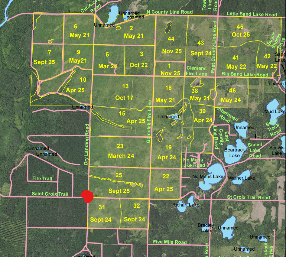
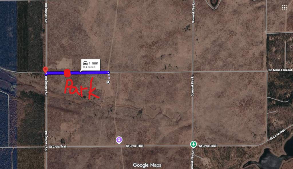
Over-view of Property – Red dot is the Dry Landing & St. Croix Intersection (46.113886, -92.091977):
Drive north on Dry Landing Rd. for 3 miles, then west on North County Road/ East Dry Landing Road for .5 mile and then south on unnamed access road for .75 mile to park at parking sign. Walk south along the firebreak for approximately .25 mile to the ‘STG Blind’ sign on the east side of the firebreak. Walk east to east of field edge.
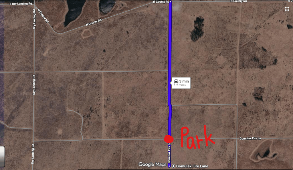
Drive north on Dry Landing Rd. for 3 miles, then east on North County Line for 1 mile, then south 1 mile on Gomulak to the parking area. Walk south approximately .25 mile to the ‘STG Blind’ sign. The blind is along the east side of the firebreak.
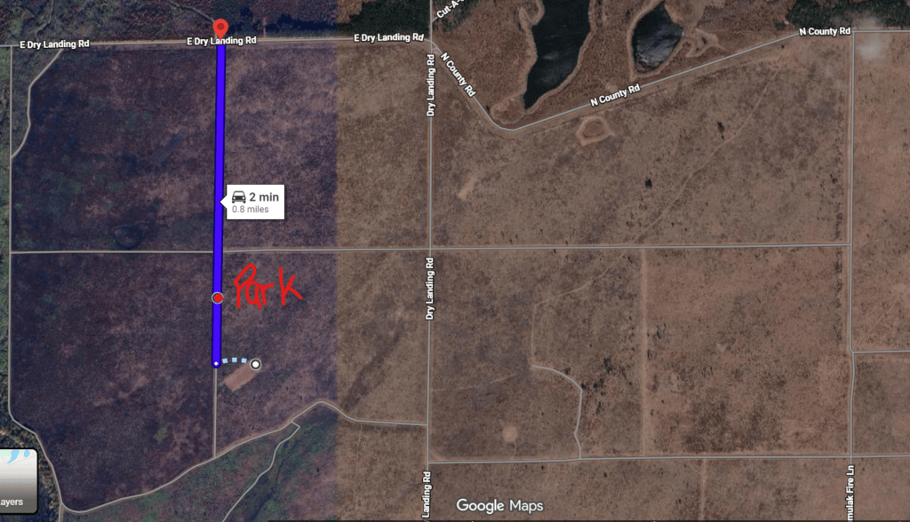
Drive north on Dry Landing Rd. for 0.5 mile, then east .25 mile on Delong-Lien Firebreak to the parking area. Walk east approximately .25 mile to the ‘STG Blind’ sign. The blind is south of the firebreak.
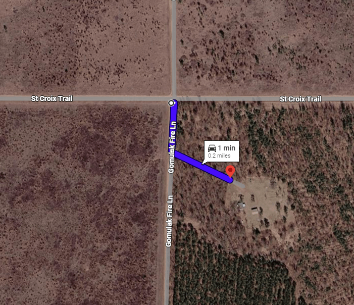
Drive east on St Croix Trail and go south on Gomulak, then take a left at the first driveway to go east to the gate. If the bathroom is available, it will be right by the gate. The exception for the public driving on Fire Lanes is the small segment of Gomulak needed from St Croix trail to get the cabin site that has the bathrooms and picnic area.
Back to Reservation Website, Viewing Blinds or DNR Protocol pages